Angus and Rosemary's Miscellany
of Malvern - Other Resources
The South Worcestershire Development Plan Review
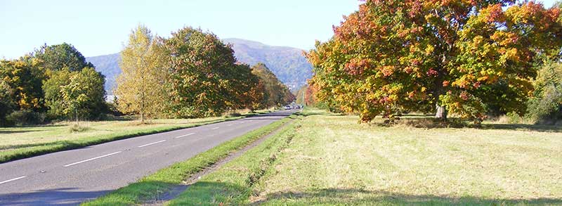
The eastern approach to Malvern along the Guarlford Road ContentsHow would the plan affect Malvern Malvern Town Neighbourhood Plan OverviewThe South Worcestershire Development Plan (SWDP) adopted in 2016 which identifies preferred areas for development covers the period to 2030. However the Government now requires plans to be reviewed every 5 years and so revised proposals are being explored to cover the period up to 2041. The timetable is: Ask land owners to offer sites for development: complete Review suitability of sites against planning criteria: complete Publish first draft of the proposals: 4th November 2019 Public Consultation: 4th November to 16th December 2019 Publish second draft of proposals: November 2020 Submit proposals for examination: February 2021 Examination: 2021 Inspector's report: October 2021 SWDPR adopted: November 2021 The plan was approved to go forward to public consultation by Malvern Hills District Council (MHDC) on 29th October 2019. It is of note that councillors were unhappy about several aspects of the proposals, but said they were being forced by Government imposed targets to make difficult and unpopular decisions. There are potentially thousands of pages and maps to look at so you will need to allocate some time if you want to comment, when you will also be thinking about the General Election, BREXIT and planning for Christmas. The immediate point to note is that the Public Consultation closes at 5 pm on 16th December.
How would the plan affect MalvernThe present plan covering the period to 2030 provides for building about 800 homes on farmland near Newland and 300 or so homes on the old RSRE (Qinetiq) brownfield site between St Andrew's Road and Poolbrook Road. The SWDPR proposes the following principal additional developments:
To view the maps and housing/employment sites click this link: https://www.swdevelopmentplan.org/?p=14376 Then scroll down the page to the list City and Towns and click Malvern. This will bring up a map of Malvern as a pdf file with the title: 'Strategic Housing and Employment Land Availability' The legend at the top right of the map shows the colours associated with housing and employment land.
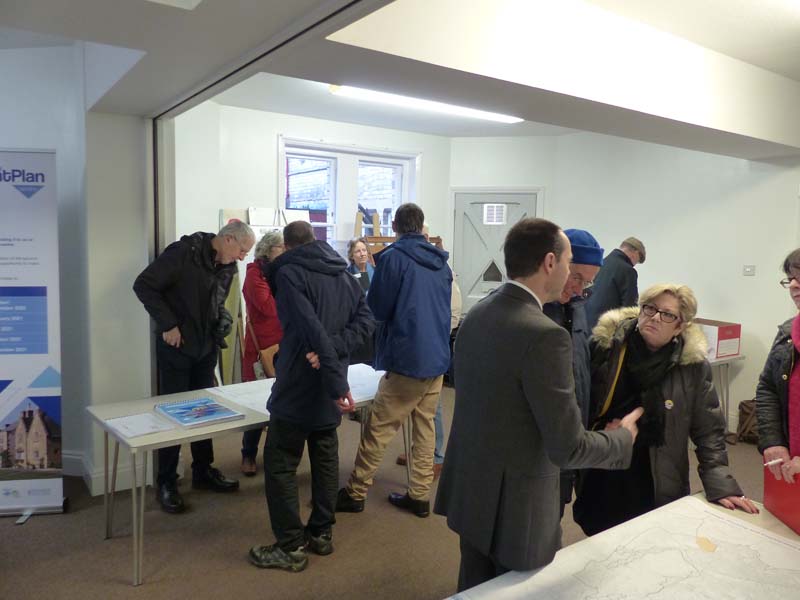
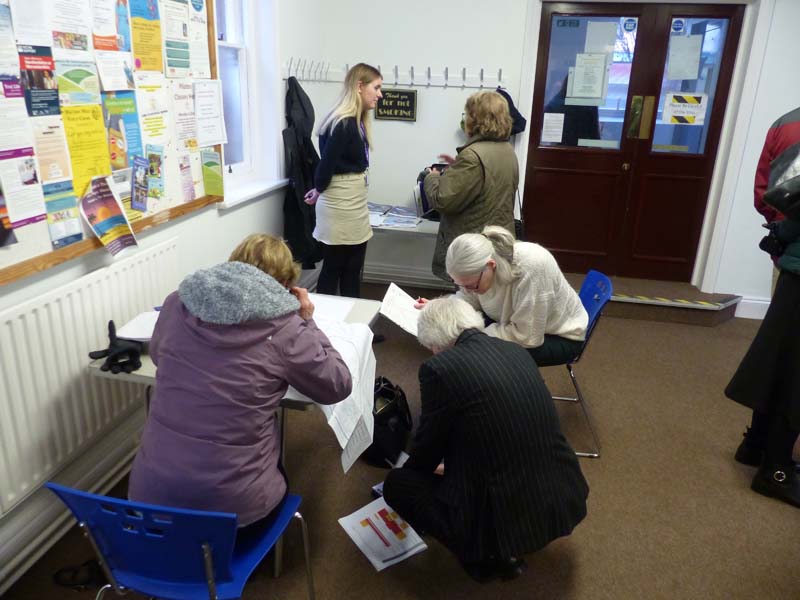
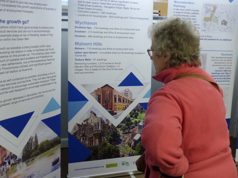
Public ConsultationThe Planning Authority held a roadshow at the Lyttleton Rooms, Malvern, on 20th November, where maps were provided showing the proposed developments, and staff were on hand to explain the proposals. Duncan Rudge said objections should be accompanied by sound planning reasons and that the volume of objections by itself would bear little weight. Another factor to consider is that if a proposed site were to be ruled out, the MHDC would be looking for another site to replace it, so be careful what you wish for. After reading about the voluminous proposals you will be able to comment online. To do this you will need to go to this webpage and register with an email address and password in order to login: https://swdp-consult.objective.co.uk/portal/swdp_review_preferred_options How to commentOnce you have logged on, click READ AND COMMENT ON DOCUMENT. This will display the Consultation Document with the index to sections on the left hand side. Click SECTION 20 MALVERN HILLS ALLOCATIONS. A summary of the sites proposed for development will be displayed. To add your comments on the proposals click the COMMENT box at the top right hand side of the page; this will open a little window in which to type your comments. You should enter the reference of the site you are commenting on and then your comments. It is recommended you enter a few new lines and then paste in your comments from another document, to prevent the box freezing. To view the maps and sites you will probably have to click this link: https://www.swdevelopmentplan.org/?p=14376 see above.
Comments can also be made by email to contact@swdevelopmentplan.org or by post to: South Worcestershire Development Plan, Civic Centre, Queen Elizabeth Drive, Pershore, WR10 1PT.
Also see this document about all the sites that have been considered, some of which have been discounted: https://www.swdevelopmentplan.org/wp-content/uploads/2019/11/Malvern.pdf
Malvern Town Neighbourhood PlanThe SWDP proposals seem to take no account of the policies in the Malvern Town Neighbourhood plan approved by the MHDC in February 2019. Click this link to find out more about the Town Plan. https://www.malvernhills.gov.uk/malvern-town-neighbourhood-plan
Brownfield sitesWe think consideration ought to be given to developing Brownfield sites before building on farmland. The list of Brownfield site can be viewed here: https://www.malvernhills.gov.uk/brownfield-land-register This list does not seem to include the old coal depot alongside the railway near County Building Supplies where 66 homes might be built. See this link: https://www.uklandandfarms.co.uk/search/detail.aspx?PropertyRef=10184_352 Some of these sites are already in the SWDP. These include:
Development of the remaining Brownfield sites in Malvern might possibly reduce the need for houses behind Baldenhall and south of the Guarlford Road; with the remaining houses placed on edge of small villages that want a few new homes. We wonder whether there is also scope for building on the Fortis Housing Association Offices vacated on the industrial estate near the Malvern Retail Park. InfrastructureThe people occupying the proposed new homes will require access to doctors, dentists, hospitals, schools, utilities, and transport networks to which of course they will contribute through council tax. However, we are concerned that town planning in recent years does not appear integrated. The road network for example is managed by WCC (Highways Dept) not MHDC. The roads in Malvern are cluttered by on-street parking, but we are lucky that the traffic flows fairly freely, and there is a regular bus service between Great Malvern and Worcester bus station. However there are issues. The Malvern Vale development on the old RSRE North site has its own supermarket, playing field, community hall, and primary school, and is close to the Dyson Perrins Secondary School. These are all plus points, but the homes on the other hand have small gardens, and the streets serving the estate are often congested. Somers Park Avenue, branching off Newtown Road, has an increasing number of speed bumps reducing traffic flow, making driving down the road an uncomfortable experience. The easterly exit from Malvern has a T junction at the Rhydd where visibility needs to be improved or traffic lights introduced. The Hanley Road regularly floods near Upton on Severn and measures need to be taken to raise the level of the road as has been done on the other side of Upton bridge. Many of the people buying new homes will be commuters as employment opportunities in Malvern are limited. Malvern has two railway stations, but there is already inadequate parking at Great Malvern, resulting in congested on-street parking in Avenue Road and surrounding streets, and the parking at Malvern Link is not much better. If planners are hell bent on building more homes, perhaps consideration should be given to building either a multi storey car park next to Malvern Link station or a new station or halt with associated parking at Newland, and/or a halt with parking at Peachfield or Malvern Wells. Possibly some common land could be compulsorily purchased to enable this. We have seen no plans for a road network to serve the proposed development at Newland (800 homes). That is very unfortunate, as the A449 joining Malvern to the motorway network is already often congested. Long traffic jams build up approaching the junctions with Callow End and the Powick roundabout. Dualling the road across the river does not seem to have improved matters but made them worse. Councillors seem to be coming round to the view that improving the road network encourages further traffic and is self defeating. Perhaps traffic lights or a flyover is needed. A further issue is that the flood plain of the river Severn can occasionally block the A449 at Powick and, if global warming is going to result in more rainfall, then raising the road here as well as at Hanley might be a good idea in order to prevent Malvern being cut off. Further from home, there is already inadequate parking provision at the Worcester Royal Hospital, and getting off the site is difficult around 5 pm due to traffic jams. We wonder what plans the hospital and Highways have to remedy the situation. CommentaryWe are told the most urgent need is for affordable homes in Malvern, including those needed by Housing Associations. These are exactly the sort of homes developers do not want to build, as there is much less profit to be made. The Government and MHDC try to overcome this reluctance by placing conditions in planning permissions, but developers are slippery customers and, so far, usually manage largely to extricate themselves from such conditions. Planners are to be congratulated on proposing new villages with proper transport infrastructure, such as at Worcester Parkway, but let us hope adequate green space is provided as envisioned by Ebeneezer Howard who designed Letchworth and Welwyn garden cities. With regard to the proposals for Malvern, we regret the proposal to build on the car park in Victoria Road below the library - SWDP52s. It's a handy place to park when visiting the library, Malvern Cube and Manor Park and should ideally only be developed as a very last resort. A better use might be to retain and provide a bank of charging points for electric cars. The land bounded by Windrush Crescent, Teme Avenue, Baldenhall, Hall Green and Madresfield Road (180 homes) - CFS0407sc is outside the development boundary but is otherwise a natural extension of the Guarlford Road estate. A gap was left near the corner of Teme Avenue where a road could be built into a small extension to the estate.
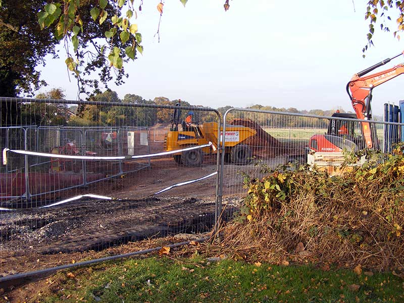
Entrance to field from Teme Avenue after sewer work in 2016 However it is to be noted Severn Trent recently built a new sewer through this field to pump sewage uphill from the pumping station near the junction of Hall Green and the Madresfield Road to the sewage works in Mill Lane.
Continuing sewer through Teme Avenue in 2016 More importantly, a few years before that, Severn Trent carried out huge excavations, in or close by, to install underground soakaways to absorb rainwater drained from Great Malvern. Planners need to consult Severn Trent as to whether this would constrain where homes could be built. Possibly fewer homes should be proposed here. Farmland to the south of the Guarlford Road between Mill Lane and the Green Dragon (180 homes) - CFS0905sc is also outside the development boundary. Over the last few years there have been a number of developments on derelict land and farmland between Poolbrook and Mill Lane and, sadly, building on farmland on the other side of Mill Lane could be a logical extension of the development boundary. It should be noted however that while the SWDP shows access from Mill Lane, this is in most places a single track road with no pavement. Development of this site would therefore need Mill Lane to be widened and permission gained for an easement across the common from the Malvern Hills Conservators (aka Malvern Hills Trust). Further building here would destroy the beautiful views for walkers and tourists crossing to the Green Dragon from the Blackmore Park caravan site.
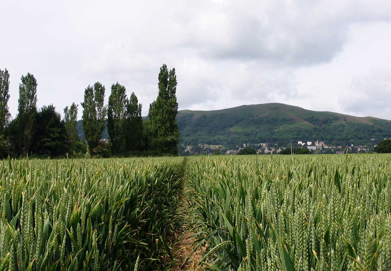
View from footpath to Mill Lane In our opinion this site should not be considered for development until the present land bank is exhausted. LinksOn the following two web pages residents of Madresfield have expressed their concerns about the proposed use of land (CFS1097) near the junction of Mayfield Road and North End Lane offered by the Madresfield Estate for light industrial use: https://www.j2e.com/MadresfieldSW/MalvernHillsView/ https://drive.google.com/file/d/1q71PfUPRexbVkdWoE_LGjbYB4U54fH2c/view Another resident has listed some points to consider insofar as the proposals affect the Chase ward. Remember, comments on the Public Consultation must be made before 5pm on 16th December 2019.
|
|
Last updated 14th December 2019 |