|
Photo Gallery >
A stroll down Abbey Road Great Malvern (return)
This page continues our stroll and records our perambulation northwards along the Wells
Road, which becomes the Worcester Road, from its
junction with Abbey Road back to Great Malvern Post Office. The panoramic
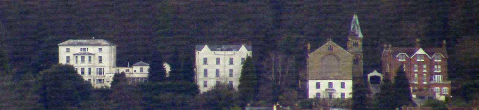
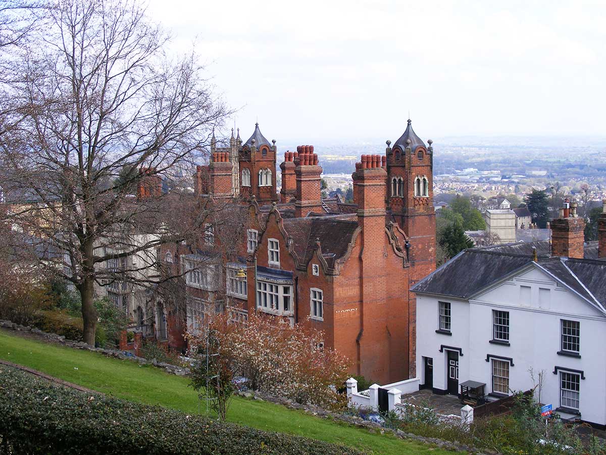
photo above shows the east side of some of the buildings you will pass,
Cherbourg House, Southlands, a chapel and an archway linking to villas next
door.
(The photo was taken with a x10 zoom lens from the B4211 Guarlford Road).
Since this photo was taken Audley Group Ltd have commenced renovating
the buildings in order to create a large retirement village on the site,
known as Audley Ellerslie, and a third block of apartments has been built
between Cherbourg and Southlands.
Cherbourg House
and Southlands
We missed it first time round, but an 1884 map of Great Malvern shows a
large house, 150 yards or so along from Ellerslie with
access onto the Worcester Road opposite the turning to the Wyche cutting.
This was probably built about 1850 and known as Cherbourg House. Pevsner describes this as Italianate with five bays.
Viewed from the eastern approach to Malvern it is a significant landmark but
was empty in 2015 and in a poor state of repair, awaiting modernisation.
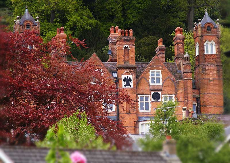
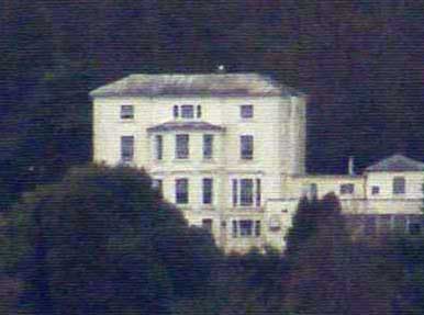 You
can't see much of Cherbourg House from the Wells Road, but the illustration
opposite, which was cropped from the panorama above, shows the
east side and part of the extension on the north side, which is a later addition,
linking the building to Southlands next door. You
can't see much of Cherbourg House from the Wells Road, but the illustration
opposite, which was cropped from the panorama above, shows the
east side and part of the extension on the north side, which is a later addition,
linking the building to Southlands next door.
A trade directory of 1862 records Mr Matthew P W Bolton in residence.
Matthew Piers Watt Bolton, or Boulton, (1820-1894) was the grandson of
Matthew Boulton an English manufacturer and business partner of famous
Scottish engineer
James Watt.
Sadly his first wife Frances Eliza Carter nee Cartwright died at Great
Malvern on 19th January 1864. The family's main residence was at
Tew Park in
Oxfordshire.
In the 1880s Cherbourg House became a school run by Frederick William Young
and Arthur Vernon Vines who also had buildings nearby at North Leasowes and Norfolk
Villas.
Ernest Wright Alexander VC (1870 - 1934) was a pupil who went on to
Harrow; his father Robert, born in Belfast but based in Liverpool, was a
prominent ship broker and a Director of the
Suez Canal Company.
In 1911 Arthur Clement Allen was the headmaster at Cherbourg House; the author
C S Lewis
apparently enjoyed going to school here, before being educated at Malvern College.
Southlands
A 1934 map of Malvern shows an additional building north of Cherbourg House known as
Southlands. This could also have been built about 1850 but possibly later.
Ellerslie, Cherbourg House, Southlands and Hampton House (see previous page)
had all been acquired by
Ellerslie school for girls during the twentieth century. Circa 1992 Ellerslie school was taken over by Malvern
College, and since becoming surplus to requirements the land was sold to a
developer.
Planning permission for a retirement village, now known as Audley
Ellerslie, was granted by the MHDC in 2012 and in 2017 work was well
underway.
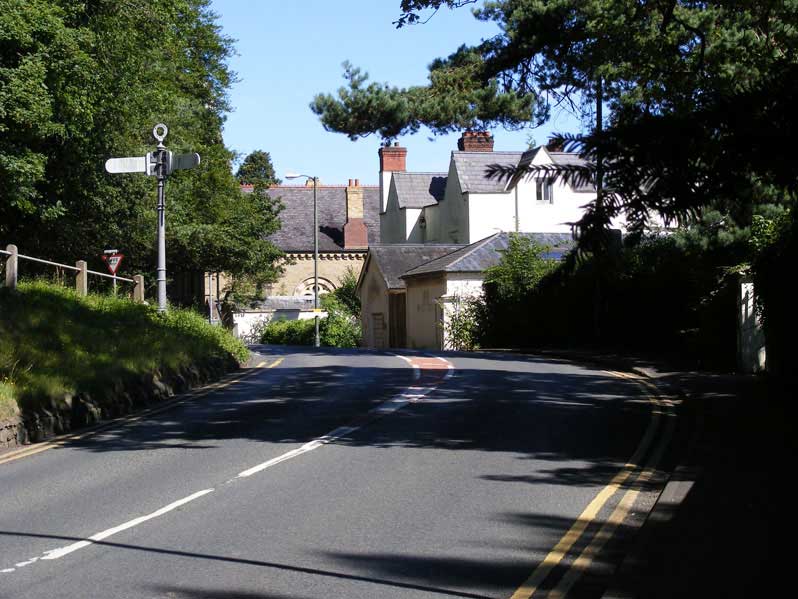
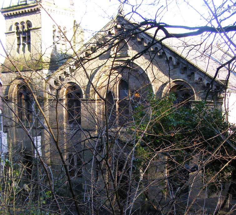
Wyche road junction
The photo below shows the junction of Worcester Road with the Wyche Road
which runs over the Malvern Hills to Colwall. Ahead can be seen an arched
window in the wall of an old chapel whose tower is hidden behind the trees
on the left. The building in front is Southlands.
At the very right of the
photo below can be seen one of the white gateposts of the old entrance to Cherbourg
House which sits on the slope below the road.
 Emmanuelle
Church Emmanuelle
Church
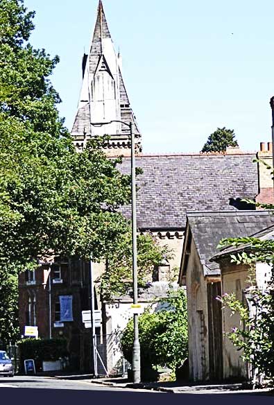
A few steps further on the tower of the chapel is revealed.
The present Chapel designed by Herefordshire architect Henry Haddon,
was built in 1874 and replaced an earlier
chapel of
brick construction erected in 1827. It was a chapel of the Countess
of Huntingdon's Connexion, which was part of the Methodist movement. It
became known as Emmanuel Church, but is now the home of the Body
Spirit Health Club which took over from Belle Vue Fitness and
Beauty Centre (ref 5).
The photo of the front of the chapel (see photo below) was taken from
across the road on the bank which runs below Rose Bank Gardens.
Despite it being winter the building was still nearly hiddden by
trees.
Emanuelle Church
The broad Lombardic detailed facade presents a rather surprising
sight amidst the Victorian Villas of the Wells Road.
Next door to the chapel was The Parsonage which in 1911 was occupied by
Peter Rose aged 42 born Kelso, Roxburgh, Minister of the Gospel.
It is from a small room below the earlier
chapel that Miss Caroline Cooper (1821 - 1873) is said to have started her first school in the 1850s
which later moved to Elmsdale and then Malvernbury in Abbey Road.
Archway
The photo below was taken from the archway between the
chapel and the block of villas next door, and shows the view looking east from the Wells Road towards Guarlford.
The photo below was taken from the same vantage point but zoomed towards
Christ Church in Avenue Road. The edge of Barnards Green can be seen on
the extreme right of the photo.
Melton House
The 1828 Foley estate map in Gualrford village hall shows the early chapel
near the turning to The Wyche and Dr Garlike's house which at that time was
the only house set midway
between the chapel and Belle Vue Terrace. Dr Garlike's property, known as
'Melton House' occupied a large plot of land between the (Wells) Worcester road and
Abbey Road. According to Pevsner the house was built circa 1818, altered by
GC Haddon in 1867 and again by Nevinson and Newton in 1894.
The photo below shows the
magestic house that stands there now.
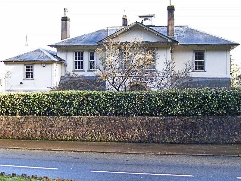
Melton House
Dr William Bennett Garlike died Great Malvern 26 April 1841. He was married
to Lydia Barbour the daughter of an attorney, and is said to have attended
Princess Victoria when she visited Malvern in 1831
In 1911 the property was known as Melton Grange and occupied by Caroline
Margaret Woods aged 84 of independant means.
Melton Cottage
Melton Cottage of similar name was possibly built later in the grounds with access onto
Abbey Road. In 1911 the property was occupied by Frederick Prosser, a
retired college porter.
Victorian Buildings
The 1884 map of Great Malvern shows only three
significant buildings between Melton House
and Belle Vue Terrace:-
Tudor House, Holyrood and Hay Well Baths (the
latter replaced
in 1894 by the Baptist Church). Warwick House would have existed but was not
labelled.
Nowadays you will find a series of slightly 'tired' Victorian
villas linked together providing shade but blocking views of the Severn Valley;
but for the fit and energetic, a splendid view can had in
all directions from the Worcestershire Beacon above St Ann's Well.
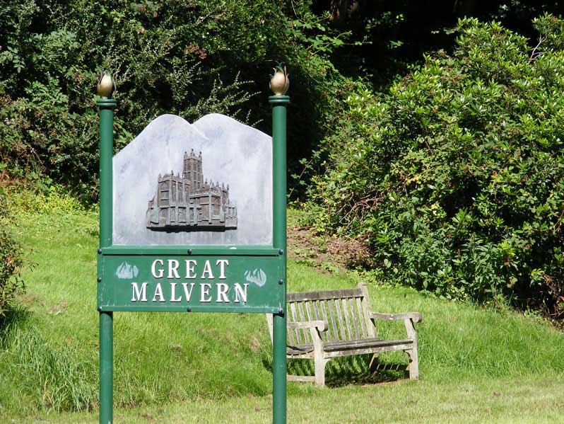 A
little further along the Wells Road, on the left hand side is a bench next to the welcome to Great
Malvern sign. A
little further along the Wells Road, on the left hand side is a bench next to the welcome to Great
Malvern sign.
Tudor House
On the right is 'Tudor House' by SS Teulon (see photo below taken from
Rose Bank Gardens).
This was built about 1852 for the
water cure doctor James
Manby Gully.
Pevsner describes the Tudor House as,
red brick in lively jacobean style, with square bay windows,
rusticated doorways, and tall chimneys.
At the rear are two tall viewing towers which can be seen in the photo below.
Next door is a white stuccoed Tudor Gothic building which
was known as 'Holyrood House' built about 1840 where Dr Gully also practised (read
more - link to article by Sue Young).
So successful was his business at Holyrood that Dr
Gully built or acquired Tudor House
on land next door to accommodate
the extra demand for his water cure patients.
Dr James Manby Gully retired to London in 1872, and the
water cure business was carried on by his partner Dr Fernie.
By 1879, hotel proprietor Elijah Finn, who also describes
himself as 'Proprietor of the Haywell Baths', is running the Tudor House,
and Dr Fernie is living in College Road. Elijah Finn, who died in 1886, had previously been a boarding house keeper at Dr Marsden's Hardwicke House in Abbey Road.
The 1871 census suggests that Holyrood, next door, was already by then
split into apartments run by lodging house keeper Catherine Brown, born
Buckinghamshire, about 1827.
Despite a serious fire in 2010 when the Tudor Hotel was
empty, the property was renovated and converted into residential apartments
circa 2012.
Tudor House in 2019
The rear of Tudor House and its viewing towers can be glimpsed from
College Road. See photo below taken following modernisation in 2015 when the
crests on the rear of the building have been painted black.
Rear of Tudor House from College Road
After Tudor House comes Holyrood House connected by a bridge with an arch
below (not shown).
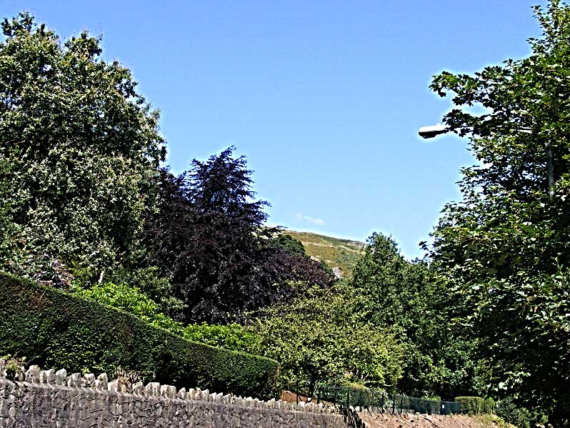
Further on, and to your left, is a glimpse of the Malvern Hills beyond Rose Bank Gardens.
Mount Pleasant
The photo below shows the approach to Belle Vue Terrace, with the
bus stop and entrance to Rose Bank Gardens on the left
(just out of picture) and the Mount
Pleasant Hotel.
If you turn left into Rose Bank Gardens and follow the
path along the boundary wall you will come to the 99 steps which lead to St
Ann's Road and Foley Terrace; from there you can follow a steep zig-zag path
to St Ann's Well. Be warned it's a stiff walk, so needs to be taken slowly by
the unfit, but there is a cafe where you can reward yourself with a cup of
tea or an ice cream, before venturing further onto the hills.
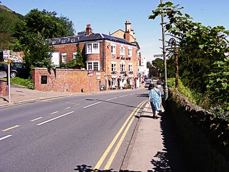
Mount Pleasant car park entrance and Hotel
On the right can be seen the Abbey Hotel Gardens, and the Abbey Hotel, with the tower
of the Priory church of St Mary and St Michael behind.
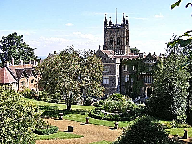
The Abbey Hotel Gardens
The photo below shows another view of the Mount Pleasant Hotel glimpsed
from Belle Vue Terrace. You can drop in here for a coffee or a meal.
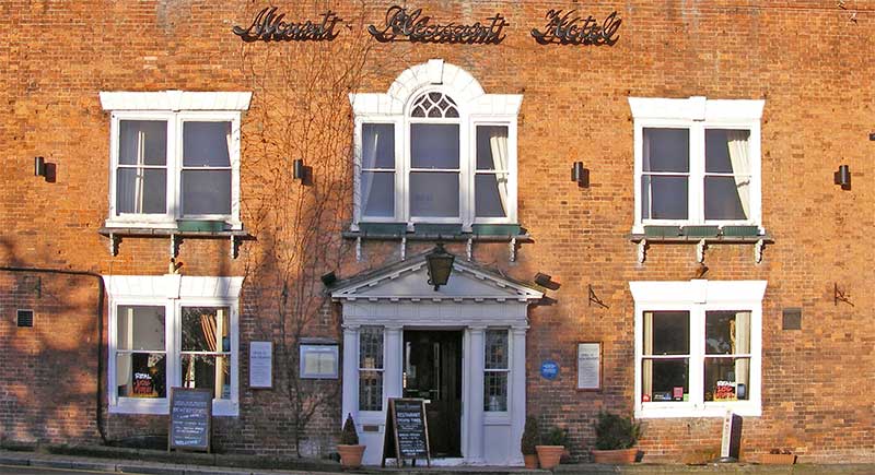
Entrance of Mount Pleasant Hotel
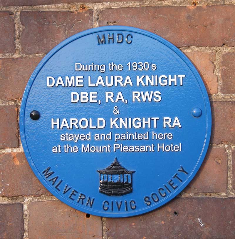 On
the right of the doorway there is a blue plaque which reads: On
the right of the doorway there is a blue plaque which reads:
During the 1930s Dame Laura Knight DBE, RA, RWS, and
Harold Knight, RA, stayed and painted here at the Mount Pleasant Hotel.
Click
to read Wikedia entry for famous artist Dame Laura Knight (1877 - 1970)
Bearing right you will see Great Malvern Post Office where you started
and the Tourist Information Centre beyond. The Post Office stands on the
site of the old vicarage, where Revd John Rashdall lived between about 1850
and 1856.
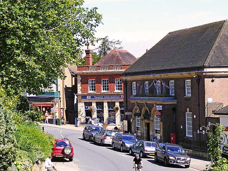
Great Malvern Post Office
Market Cross
If you look up to your left just before you reach the Post Office you will see
the Market Cross towards the south end of Belle Vue Island.
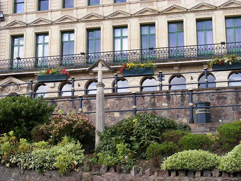
Great Malvern Market Cross
Tourist Information
 We hope you enjoyed this short 'virtual' stroll down Abbey Road and back
via the Worcester Road to Great Malvern Post Office. Perhaps the photos of
the varied Victorian buildings and snippets of information about the water
cure doctors will inspire you to find out more into the history of the town. We hope you enjoyed this short 'virtual' stroll down Abbey Road and back
via the Worcester Road to Great Malvern Post Office. Perhaps the photos of
the varied Victorian buildings and snippets of information about the water
cure doctors will inspire you to find out more into the history of the town.
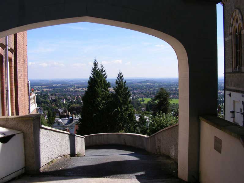
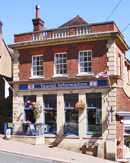
You can find out more about the local area by visiting the Tourist
Information Centre which is currently located at the top of Church Street (see photo opposite); Malvern
Museum at the Abbey Gateway; and the local reference section at Malvern Library.
Books and booklets about the area can also be found in the 'shop' in Great
Malvern Priory which is on the left as you enter the church, and at the Malvern
Book Coop in St Ann's Road.
Note on historical records
The 1871 census records, for this area of Great Malvern, do not appear to
follow a logical sequence, so you may find the index
of house names held by the Worcester Record Office useful if you are
researching local history. Called a street index it actually lists property
names in the order they were filed in the census books. The 1871 records fall under the Ecclesiastical District: St Michael and St
Mary, census reference RG10/3053 (district 5).
Stevens directories 1900 - 1930, held by Malvern Library,
are another useful resource listing houses by their order in the street.
These were the brainchild of MT
Stevens who founded the Malvern Gazette.
You can find out a little more about this area of the
town by clicking the
links below.
Rose Bank Gardens
More about shops in Worcester Road
Go to history menu
References
- Census of England and Wales 1851 - 1911
-
Malvern
and its famous visitors, Malvern Civic Society, printed by Aspect Design;
this contains a list of the many blue and green plaques which can be
found in the town.
- Weaver Cora and Osborne Bruce, Aqua Malvernensis, a history and
topography of the springs, spouts, fountains and wells of the Malverns,
and the development of the public water supply, printed by Aldine Press,
1994.
- Hall-Jones Roger, The Story of Park View Malvern, published and
printed by First Paige, Abbey Road, Malvern, 1998.
- Ellis Rod, Dissenters All, the story of the non-conformist churches of
the Malverns, printed by Aspect Design 2008.
- Maps of Great Malvern 1884 and 1934, Malvern Library
- Moody Catherine, Silhouette of Malvern from Queen Victoria to Queen
Elizabeth II, The Priory Press, Malvern, 1953.
- Brooks Alan and Pevsner Nikolaus, The Buildings of England,
Worcestershire, Yale University Press, 2007.
- Map of Foley Estate 1828.
- Grierson Janet, Dr Wilson and his Malvern Hydro, published by Malvern
Museum 1998.
- Conolly Pauline, The Water Doctor's Daughters, Robert Hale, 2013.
Previous page
 Back to top Back to top
Please email suggestions for corrections or additions to this page to
the webmaster
|